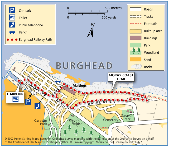
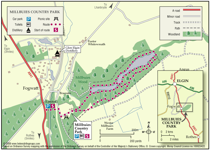
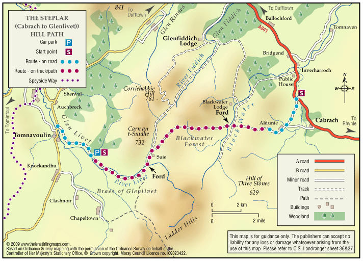
Burghead – Clarkly Hill Circular
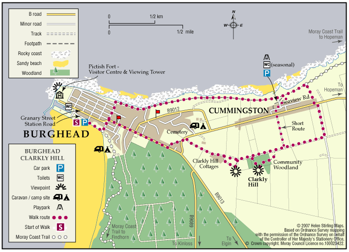
A circular walk starting in the Pictish Fort town of Burghead and passing through farmland and rocky shores, with stunning views of the Moray Firth along the ridge of Clarkly Hill.
- Low Level Walk
- Moderate
- 3.5 miles (5.6 km)
- 1h 45 minutes
- Burghead
- Unsuitable for wheelchairs and buggies
Terrain: Varied surfaces
Tarred pavements & roads, gravel paths, and earth/grass paths along the Clarkly Hill sections. Note: the earth paths are rough and uneven in places and can be muddy.
Gradient: Generally level
A gentle slope rising from the Burghead - Lossiemouth road to Clarkly Hill
- Fully signed